Kenting spearfishing forecast — wind, swell, visibility, tides & live cameras

Kenting · Taiwan
2.5
🌫 Murky all week after the storm — the water isn't settling
visibility1m

Today — sit it out — wave, wind and surge pounding. 🌫 Murky all week after the storm — the water isn't settling

Sources: Open-Meteo · Copernicus — high confidence · data 15:22

Sources & confidence

Sources
Open-Meteo · Copernicus
Method
spearo sea-state engine: consensus of up to 6 models + satellite clarity (ZSD) + buoy-bias checks
Freshness
Re-read every hour, per coast

Compiled by the spearo sea-state engine · How it works →

The verdict comes from seven water factors and hard safety gates — not ten tabs. Go or stay.

How we score the water

Our own model

Our own forecast engine — not a third-party widget. It weighs these water factors into one go-or-stay verdict for this coast; the 0–10 dial is that verdict, read out as a number.

Swell & wave memory
Height, period and direction of the swell, plus the wake of recent storms — an old storm still stirs the water, and the engine remembers.
Wind & gusts
Speed and gusts, hour by hour — wind speed and an onshore push chop the surface and cut visibility.
Tide phase
Timing and range of the tide, calibrated per coast — big spring tides pull the verdict toward caution.
Water temperature
Sea-surface temperature — sharply cold water vetoes a green verdict.
Currents & outflow
Direction and drift of the current — it pushes you, and it drags turbid coastal water across where you dive.
Rain runoff & air clarity
Rain muddies the water inshore through land runoff, while fog and haze cut visibility at the surface.
Coast shape & exposure
How the coast faces the swell — a sheltered cove keeps the water clean; an exposed, head-on point takes a penalty.

Safety gates

  • Thunderstorm forecast — rules out a green verdict.
  • An official warning (MeteoAlarm / IPMA) — yellow, or red for the higher ranks.
  • Missing input data — a would-be green is capped to yellow rather than overstated.
  • Strong disagreement between forecast models — a green day is pulled back to yellow.
  • Night hours — where night spearfishing is banned by law the window is forced red; where it is legal (Australia outside NSW, New Zealand, South Africa) it is capped at yellow, never green.

It all folds into a single 0–10 score and one verdict: go or stay.

A forecast, not a guarantee — the sea has the last word.

Where to get in, where to hunt

Entry points with coordinates
Seabed relief — promising ground

Kenting diving conditions this week

Kenting, Taiwan: Spearo's AI forecast finds no clearly good day to dive this week. Today: visibility around 1 m, waves of 1.9 m, wind at 34 km/h and water at 27 °C. Forecast updated on November 22 at 15:22 local time.

Sources: Open-Meteo · Copernicus · updated November 22, 15:22

7-day forecast for Kenting
DayVisibilityWavesWindWaterConditions
Sun, Nov 221 m1.9 m34 km/h27 °CPoor
Mon, Nov 231 m2 m29 km/h27 °CPoor
Tue, Nov 241 m1.6 m11 km/h27 °CPoor
Wed, Nov 251 m2.4 m38 km/h26 °CPoor
Thu, Nov 261 m1.6 m15 km/h27 °CPoor
Fri, Nov 273 m1.1 m7 km/h27 °CPoor
Sat, Nov 283 m1.1 m14 km/h27 °CPoor

This verdict — in your pocket. Open the app for the week's window.

Google Play — QR code
point your camera
0 m

Surface

Wind, wave and the swell windows — when to go and the best hours.

spearo.app
updated 15:22
Kenting — solo, off the rocks
DON'T GO
don't go · wave 1.9 m (occasionally up to ~3.8 m)
wave 1.9 mwind 34, gusts 62 km/hsurge pounding the rocksvisibility ~1 m
today, best window 15:00–18:00
fish · Visibility 1 m · Water 26.7°C
confidence low · verdict for the selected day
Whole week — tap a day. is driving swell right now.
Solo risk: carry a float · tell someone your plan and exit time · doubt = don't go. A model-based planner; the call is made on site.
Selected day

Windows, hours
and the day's trends.

The day is picked above, in the hero. Here are that day's windows, the hour-by-hour map and the trends. Tap a window to break down the conditions.

Sunday · today2026-11-22
06:12–17:12 · waxing gibbous
▲ 04:00▼ 10:00▲ 16:00▼ 23:00mid-range tides · 1.1 m
Hours (06→20)
06
09
12
15
18
Day's trends
Tide0.05 m
Wave1.88 m
Wind30 km/h
Water27 °C
fish activity: moonset 03:25 · moderate · moon underfoot 09:20 · high · moonrise 15:05 · moderate · moon overhead 21:40 · high
Conditions window15:00–18:00
don't go fish
Hs 1.88 m · roughperiod 6.8 swind 34→62surge 2.7viz 1 m
1.88 mrough · up to ~3.76 · 128° at an angle
6.8 sswell moderate
34→62gusts 62 km/h
2.7pounding the rocks
0.86m/s
1 mrecent swell
26.7°C5 mm + hood
▼23:00tide turn near
Atmosphere33 kmovercast
moderatemoonrise
  • wave 1.9 m (occasionally up to ~3.8 m)
  • steep wind-wave — choppy surface, careful on entry
  • just after high water
confidence lowtwilight
Open the seafloor map with entry points

Your best window — with you. Forecast in your pocket.

Google Play — QR code
point your camera
−10 m

The water column

Visibility and what drives it — post-storm clearing, river plume, temperature and the thermocline.

What it is

A marine instrument,
go / no-go for solo hunting.

spearo.app folds wind, wave, swell period, visibility, tides, water temperature and risk into a single verdict — go to the spot or not. It computes 7 days ahead from open marine models (Open-Meteo, IPMA), with no sign-up and no accounts. Built for solo spearfishing off the rocks, where any mistake costs dearly.

Now live: 3102 spots across 422 stretches of coast — mainland Portugal, Madeira and the Azores.

See all spots
−20 m

The seabed

Relief and bottom type, tides, and the depths of each spot.

On the rock

The forecast is the plan.
The call is on the rock.

The models set the window. Whether you go in is read only at the water: count the sets, watch the surge on the entry. If in doubt, you don't get in.

Entry points

Where to get in
off the rocks.

Scouted entries, coloured by today. The colour is the sea state at the spot, not a guarantee: the wash and a slippery entry you judge on site.

Open the seafloor map
Chuanfan RockKenting
dangerous
⚠ Restrictions apply
exposed head-on to the swell today
window
—
Spot location
coordinates approximate

Listed dive point in Kenting National Park (船帆石); shore entry. No spearfishing — national park. Coords from a dive-point list, approx.
Google Maps
HojieKenting
dangerous
⚠ Restrictions apply
exposed head-on to the swell today
window
—
Spot location
coordinates approximate

Listed dive point in Kenting National Park (合界); shore entry. Dive catalogue lists 20 m on average and up to 30 m. No spearfishing — national park. Coords from a dive-point list, approx.

Google Maps
HongchaikengKenting
dangerous
⚠ Restrictions apply
exposed head-on to the swell today
window
—
Spot location
coordinates approximate

Listed dive point in Kenting National Park (紅柴坑); shore entry. No spearfishing — national park. Coords from a dive-point list, approx.

Google Maps
Houbihu Channel WestKenting
dangerous
⚠ Restrictions apply
exposed head-on to the swell today
window
—
Spot location
coordinates approximate

Listed dive point in Kenting National Park (後壁湖航道西側); shore entry. Dive catalogue lists up to 11 m. Boat channel next to the site. No spearfishing — national park. Coords from a dive-point list, approx.

Google Maps
Houbihu Marina EastKenting
dangerous
⚠ Restrictions apply
exposed head-on to the swell today
window
—
Spot location
coordinates approximate

Listed dive point in Kenting National Park (後壁湖遊艇港東側); shore entry. Marina traffic nearby. No spearfishing — national park. Coords from a dive-point list, approx.

Google Maps
HouwanKenting
dangerous
⚠ Restrictions apply
exposed head-on to the swell today
window
—
Spot location
coordinates approximate

Listed dive point at Houwan (後灣), north of Kenting; shore entry. Near the national park boundary — see the legal note. Coords from a dive-point list, approx.

Google Maps
Nuclear Plant 3 OutletKenting
dangerous
⚠ Restrictions apply
exposed head-on to the swell today
window
—
Spot location
coordinates approximate

Listed dive point in Kenting National Park (第三核能發電廠出水口); shore entry. Warm-water outlet; divers report giant trevally. No spearfishing — national park. Coords from a dive-point list, approx.

Google Maps
TiaoshiKenting
dangerous
⚠ Restrictions apply
exposed head-on to the swell today
window
—
Spot location
coordinates approximate

Listed dive point in Kenting National Park (眺石); shore entry. No spearfishing — national park. Coords from a dive-point list, approx.

Google Maps
WanlitongKenting
dangerous
⚠ Restrictions apply
exposed head-on to the swell today
window
—
Spot location
coordinates approximate

Listed dive point in Kenting National Park (萬里桐); shore entry. No spearfishing — national park. Coords from a dive-point list, approx.

Google Maps
XiaowanKenting
dangerous
⚠ Restrictions apply
exposed head-on to the swell today
window
—
Spot location
coordinates approximate

Listed dive point in Kenting National Park (小灣); shore entry. Swimming beach on Kenting main street. No spearfishing — national park. Coords from a dive-point list, approx.

Google Maps
SOLO is the biggest risk: underwater you can black out from lack of oxygen silently and fatally, with no one around. Solo is never truly «safe». Below are the best weather windows; carry a buoy, tell someone your plan and exit time, and any doubt — don't go.

What you meet here

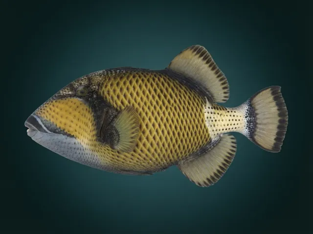
  • Titan Triggerfishsometimes
    褐擬鱗魨
  • Bigfin Reef Squidrare
    萊氏擬烏賊
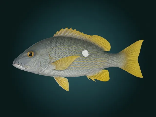
  • White-spotted Snapperrare
    白星笛鯛
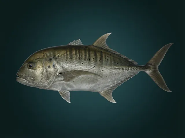
  • Giant trevally
    珍鰺
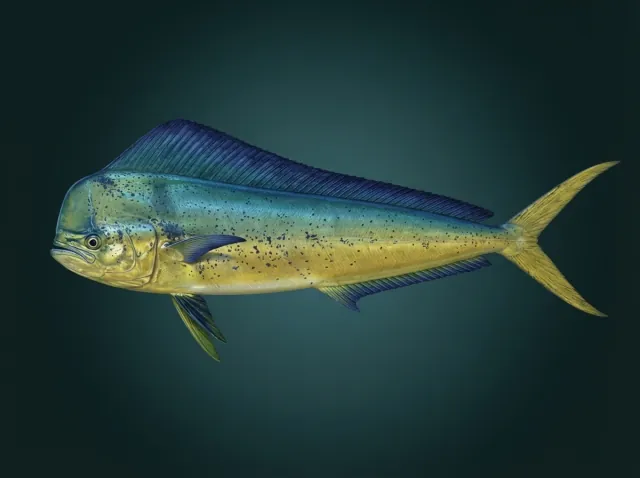
  • Common Dolphinfish
    鬼頭刀
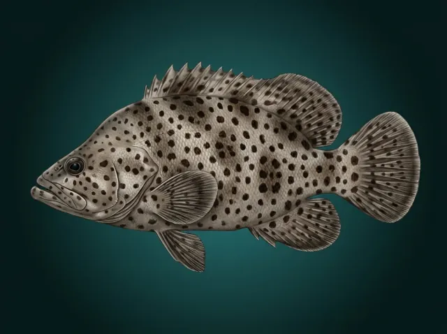
  • Humpback Grouper
    駝背鱸
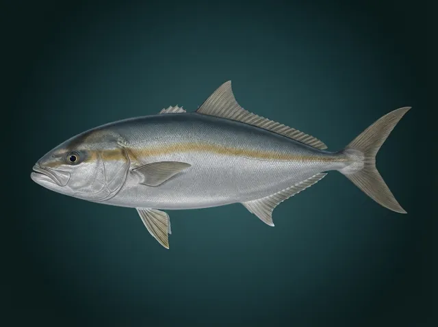
  • Greater amberjack
    杜氏鰤
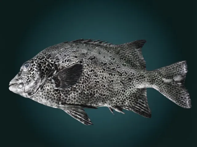
  • Spotted Knifejaw
    斑石鯛
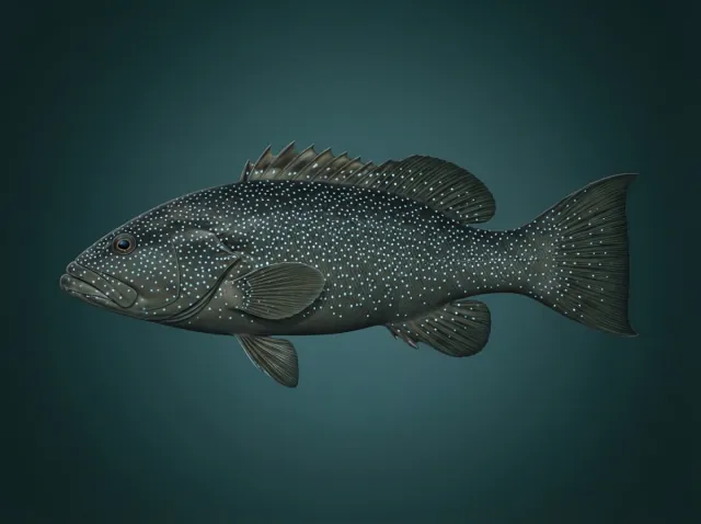
  • Leopard Coralgrouper
    花斑刺鰓鮨(豹紋鰓棘鱸、東星斑)
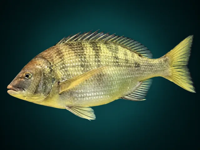
  • Blackhead Seabream
    黑棘鯛
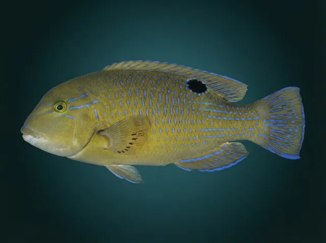
  • Blackspot Tuskfish
    邵氏豬齒魚
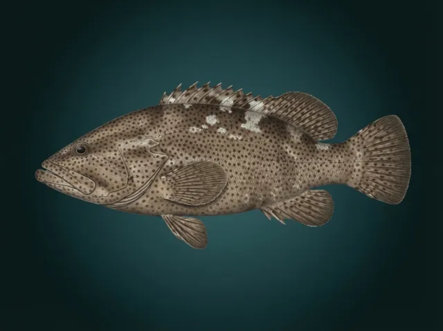
  • Malabar Grouper
    瑪拉巴石斑魚
All species (1495) — in the app

One morning glance — and you know.

Google Play — QR code
point your camera
≈

Surfacing

Cameras, map and reference — to hand as you come up.

Live cameras, map & reference
Open the seafloor map →
Reference

What's in season,
what the law says.

In season now
  • no targets this month
Law
Safety protocol
  • Sets: watch the wave trains ≥15 min before entering; Hmax ≈ 2×Hs, the wash can run 50 m past the foam line. A lull >10 min with period >12 s = a big set «overdue», do NOT enter; enter right after a full set passes and re-check at minute 30.
  • Exit FIRST: find your exit AND a backup before entering. On a rocky/boulder shore a 0.5 m rise in swell can make the exit impossible — getting pinned/unable to climb out is the main killer.
  • Headland rip: prominent points often have a permanent topographic rip regardless of the model — locate it, enter/exit on the windward side, never swim against it.
  • Cold: wetsuit per the SST chip; the first shiver = a metabolic surge and a drop in breath-hold → get out at the first steady shiver. Cap the session at 45–60 min below 15 °C.
  • Solo discipline: buoy up; tell someone the spot and exit time; conservative breath-hold (never push it in cold/murky/surfy water); visibility <3 m — don't enter.
  • Afternoon wind: on many coasts the wind builds from midday — plan to be out of the water by midday; the chop builds — get out.
  • UV 11:00–15:00 (UVI ≥6): sunscreen and cover up on the surface interval.
  • Solo is a fundamental risk (hypoxic blackout with no buddy). Any doubt = No-go.

FAQ — spearfishing in Kenting

Where can I spearfish in Kenting?

Taiwan: a speargun counts as a firearm under the weapons act — you need a police licence and must carry it with you; at most two spearguns per person (Weapons Control Act Art. 4; Permit Rules Art. 8). Kenting has rock entry points for freediving and snorkelling such as Houbihu Channel West, Houbihu Marina East and Nuclear Plant 3 Outlet. Below you'll find each spot (access, shelter and hazards) and today's forecast.

When is the best season in Kenting?

April–June and September–October in calm spells; typhoons usually July–October; the winter NE monsoon shuts the northeast coast (Doufu Cape at Su'ao is sheltered).

How cold is the water in Kenting?

Visibility per dive catalogues: 5–10 m at Longdong and Kenting, 10–30 m and more at Green Island and Lanyu. Spearo's AI forecast puts the water temperature at Kenting at 27 °C today, between 26 and 27 °C over the next 7 days. Today: visibility around 1 m and waves of 1.9 m.

Is Kenting good for a beginner?

Moderate–hard: the Kuroshio runs at 1–2 m/s off the east coast, typhoon swell, boats near dive sites; a speargun counts as a firearm and needs a police licence (槍砲彈藥刀械管制條例 Art. 4; 槍砲彈藥刀械許可及管理辦法 Art. 8); fishing is banned in Kenting National Park (國家公園法 Art. 13(2)). Today in Kenting Spearo's AI forecast shows visibility around 1 m, waves of 1.9 m and wind at 34 km/h; the 7-day table above rates each day as good, marginal or poor.

Do I need a licence in Kenting?

Kenting: Taiwan: a speargun counts as a firearm under the weapons act — you need a police licence and must carry it with you; at most two spearguns per person (Weapons Control Act Art. 4; Permit Rules Art. 8). Fishing is banned in the national parks (Kenting, South Penghu; 國家公園法 Art. 13(2)); fishery conservation zones follow county notices (漁業法 Art. 44), and some are closed to any catch. A 3 nm speargun restriction (Wanli to the Yilan border) was proposed by New Taipei on 17 June 2026 (draft 新北府農漁字第1152538607號); we have not verified whether a final notice has taken effect — check the latest county notices.

Coming soon

Get the go / no-go verdict for Kenting by email

Leave your email — and the moment a window opens at Kenting, we'll send the go / no-go verdict. Email is all we need.

Optional: city, channel, phone
What to send
Where to send it
More spots

Spots in Taiwan

spearo.app — All countries

Feedback

Help us make it better

What's missing? Tell us what you'd like to see — new spots, species, data or features. We read everything.